


![Fig. 3 - Digital Elevation Model (SRTM) in the area of points No. 5 and 6. DEM analysis of river basins and catchment's divides: Rio Dicaro and Rio Nashiño belong to different basins: the first one flows into the Yasuní River, the second one into the Curaray River. Therefore “following downstream the Rio Dicaro till point No. 7 by the Rio Nashiño” (Art. 1, indent 3) [15] becomes a “geographical nonsense” in mapping out the perimeter section from points No. 6 to that No. 7](http://www.geoyasuni.org/wp-content/uploads/2013/07/fig_3-900x440.jpg)
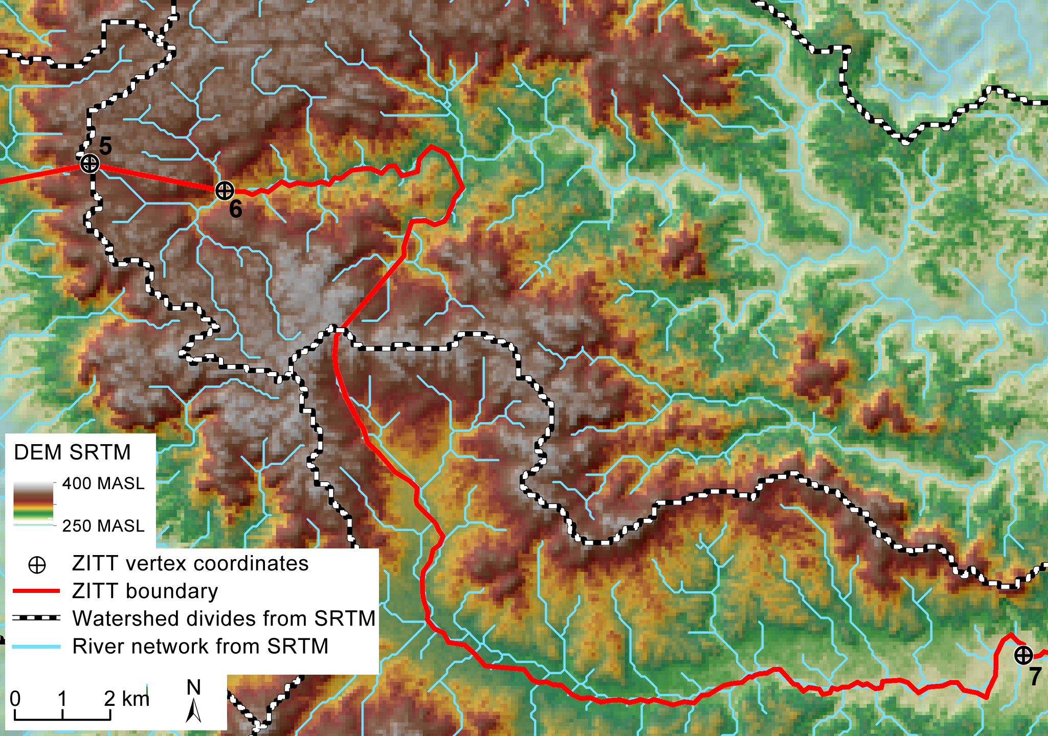
Fig. 3 – Digital Elevation Model (SRTM) in the area of points No. 5 and 6. DEM analysis of river basins and catchment’s divides: Rio Dicaro and Rio Nashiño belong to different basins: the first one flows into the Yasuní River, the second one into the Curaray River. Therefore “following downstream the Rio Dicaro till point No. 7 by the Rio Nashiño” (Art. 1, indent 3) [15] becomes a “geographical nonsense” in mapping out the perimeter section from points No. 6 to that No. 7