« Zona Intangible Tagaeri Taromenane – Mapas en Plos ONE

Figure 5

Fig. 5 - Spatial analysis of perimeter section between points No. 7 and No. 8 processing satellite scenes from Landsat TM 5. show more  Landsat Thematic Mapper (TM) false color composite (4 blue, 5 green, 7 red) of the territory encompassed between points No. 7 and No. 8 in the southern sector of the Oil Block 31 (PetroAmazonas). Boundary section (red color line) does not match the Rio Nashiño river bed (yellow color line).

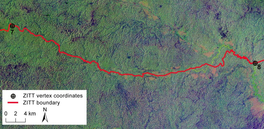
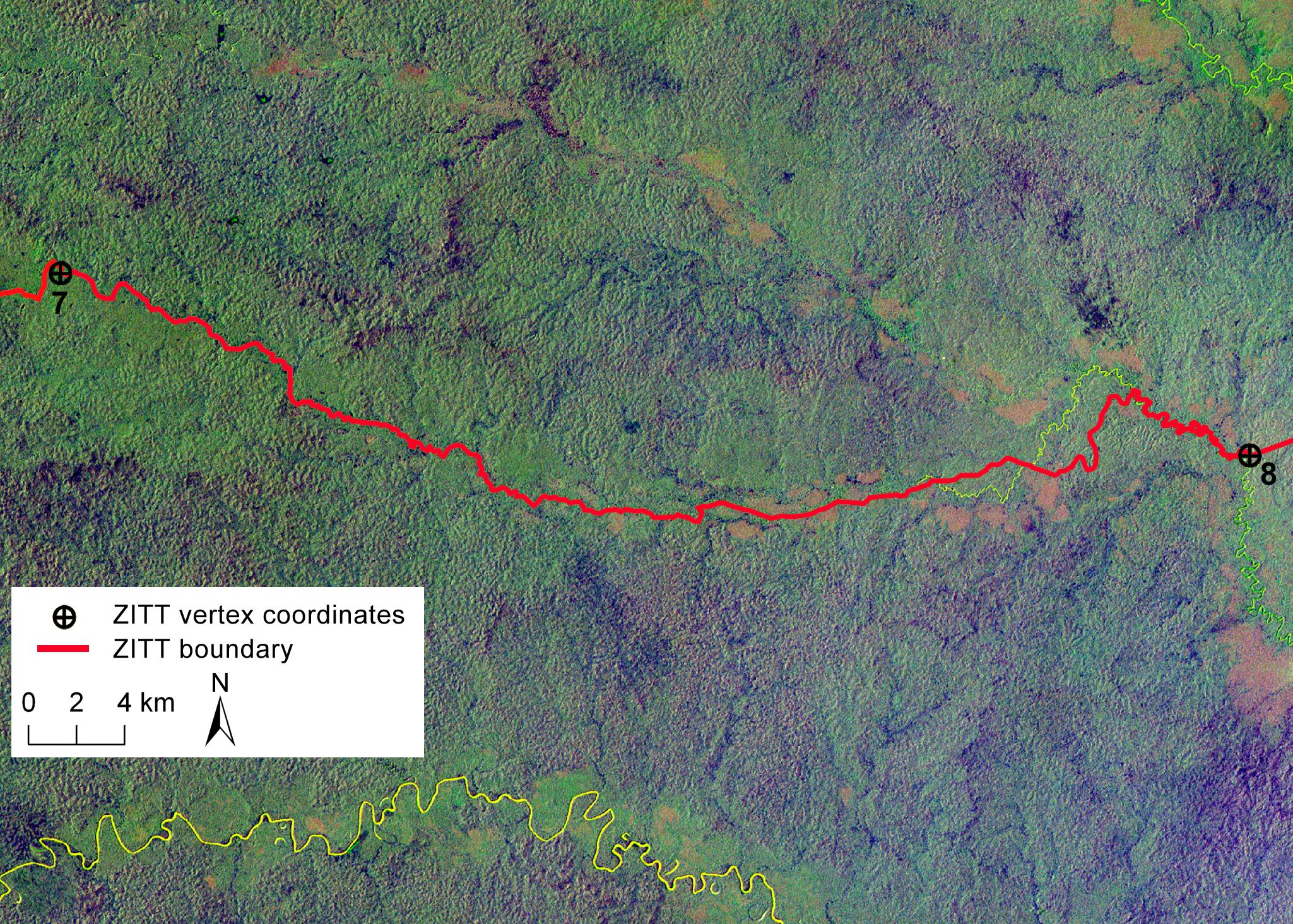
Fig. 5 – Spatial analysis of perimeter section between points No. 7 and No. 8 processing satellite scenes from Landsat TM 5. show more Landsat Thematic Mapper (TM) false color composite (4 blue, 5 green, 7 red) of the territory encompassed between points No. 7 and No. 8 in the southern sector of the Oil Block 31 (PetroAmazonas). Boundary section (red color line) does not match the Rio Nashiño river bed (yellow color line).

Aggiungi ai preferiti : permalink.

Lascia un Commento