« Zona Intangible Tagaeri Taromenane – Mapas en Plos ONE

Figure S3 (PloS ONE)

Comparative GIS analysis of catchment's divides by different Digital Elevation Models. Catchment's divides are obtained by three different DEM maps (IGM Ecuador, SRTM, GDEM). Even if they present some spatial differences, all of them confirm that points No. 5 and No. 6 belong to different river basins. The first one belong to the Rio Yasuni, the second one to the Rio Curaray.

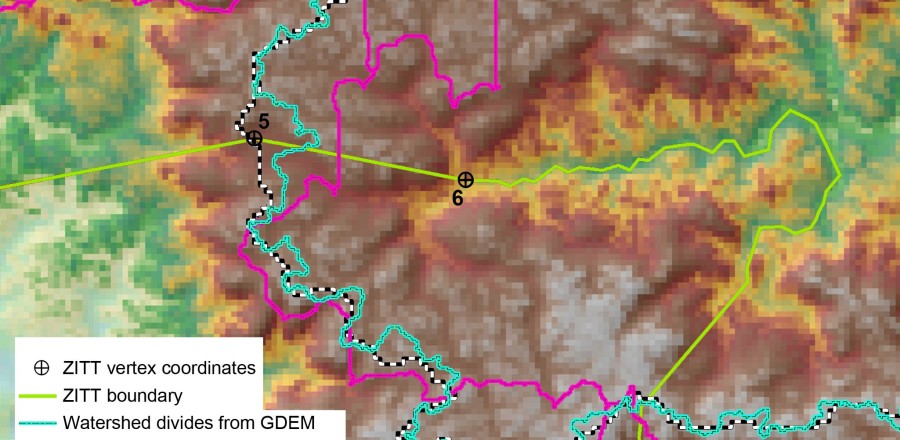
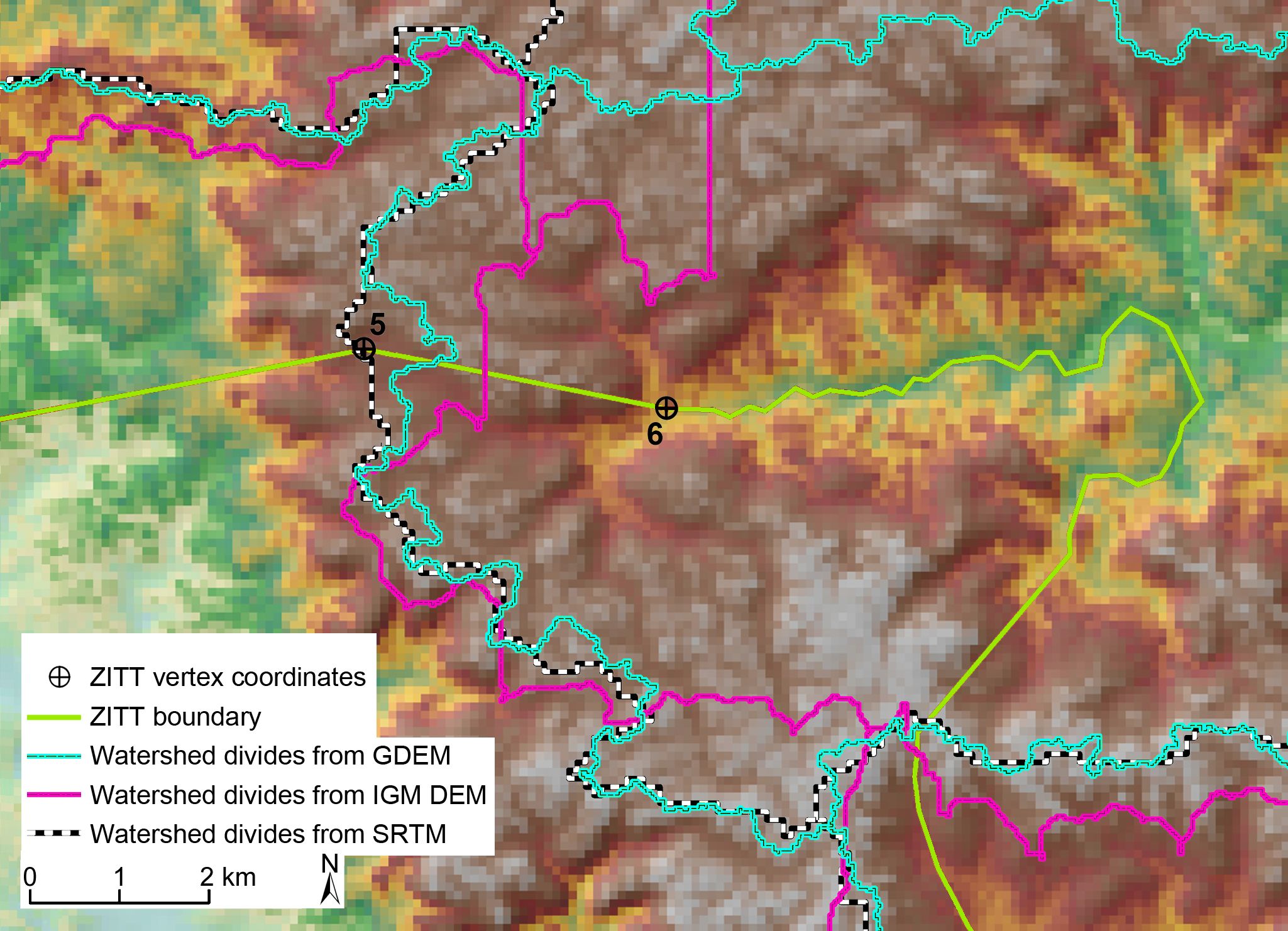
Comparative GIS analysis of catchment’s divides by different Digital Elevation Models. Catchment’s divides are obtained by three different DEM maps (IGM Ecuador, SRTM, GDEM). Even if they present some spatial differences, all of them confirm that points No. 5 and No. 6 belong to different river basins. The first one belong to the Rio Yasuni, the second one to the Rio Curaray.

Aggiungi ai preferiti : permalink.

Lascia un Commento