


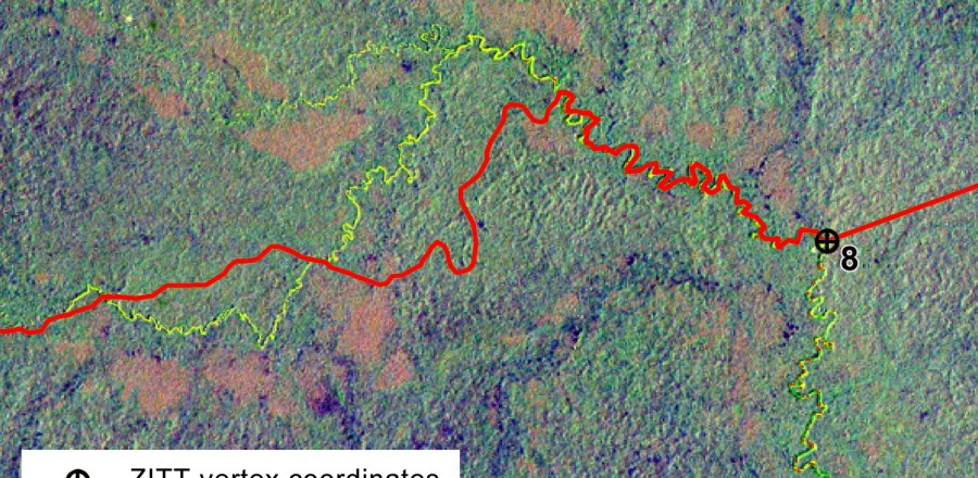
Detail of the Landsat TM 5 satellite scene and the boundary section close to point No. 8. The boundary section drifts away from the Rio Nashiño riverbed runs over a hill’s ridge in two spots, violating both the terrain morphology and the same official text (Decree 2187, 2007).