« Zona Intangible Tagaeri Taromenane – Mapas en Plos ONE

Figure 8

Fig. 8 - Synthesis map of the Zona Intangible. Recognizing the complex territory of uncontacted Tagaeri Taromenane: from geometry to geography.  The map results from the combination of human right policies (Zona Intangible Tagaeri Taromenane) representing also the Buffer Zone (normally avoided in official maps), the oil concessions for hydrocarbon production and the spatial patterns of Tagaeri Taromenane (combining the results of data about paths and presences). Considering the power of images in shaping territorial representation, cartography science has the responsibility in formulating more complex discourses about controversial territories.

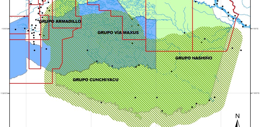
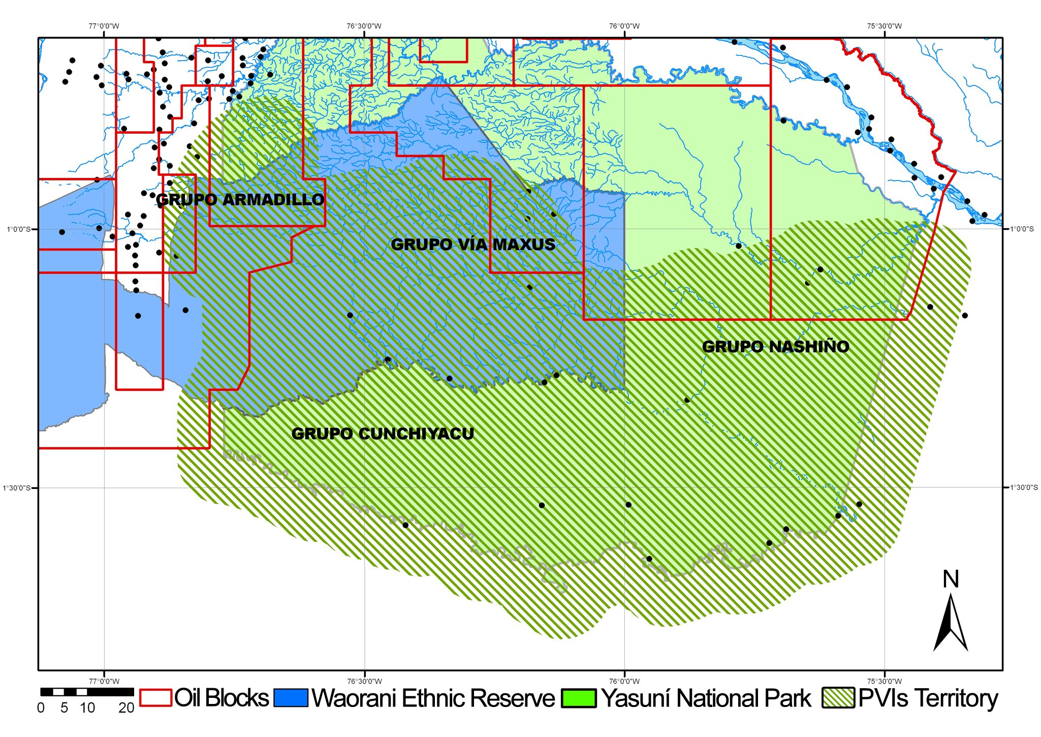
Fig. 8 – Synthesis map of the Zona Intangible. Recognizing the complex territory of uncontacted Tagaeri Taromenane: from geometry to geography. The map results from the combination of human right policies (Zona Intangible Tagaeri Taromenane) representing also the Buffer Zone (normally avoided in official maps), the oil concessions for hydrocarbon production and the spatial patterns of Tagaeri Taromenane (combining the results of data about paths and presences). Considering the power of images in shaping territorial representation, cartography science has the responsibility in formulating more complex discourses about controversial territories.

Aggiungi ai preferiti : permalink.

Lascia un Commento