« Zona Intangible Tagaeri Taromenane – Mapas en Plos ONE

Figure 4

Fig. 4 - Digital Elevation Model (SRTM) analysis between points No. 7 and 8: a critical mapping out of the Zona Intangible Tagaeri Taromenane (ZITT).  Figure 4. Digital Elevation Model (SRTM) analysis between points No. 7 and 8: a critical mapping out of the Zona Intangible Tagaeri Taromenane (ZITT). show more  The DEM analysis of river dynamic clearly shows that the boundary section, rather than overlapping the Rio Nashiño river bed, drifts away from the river course running over a hills line upper slope. This mapping out violates both the terrain morphology and the same official text (Decree 2187, 2007)

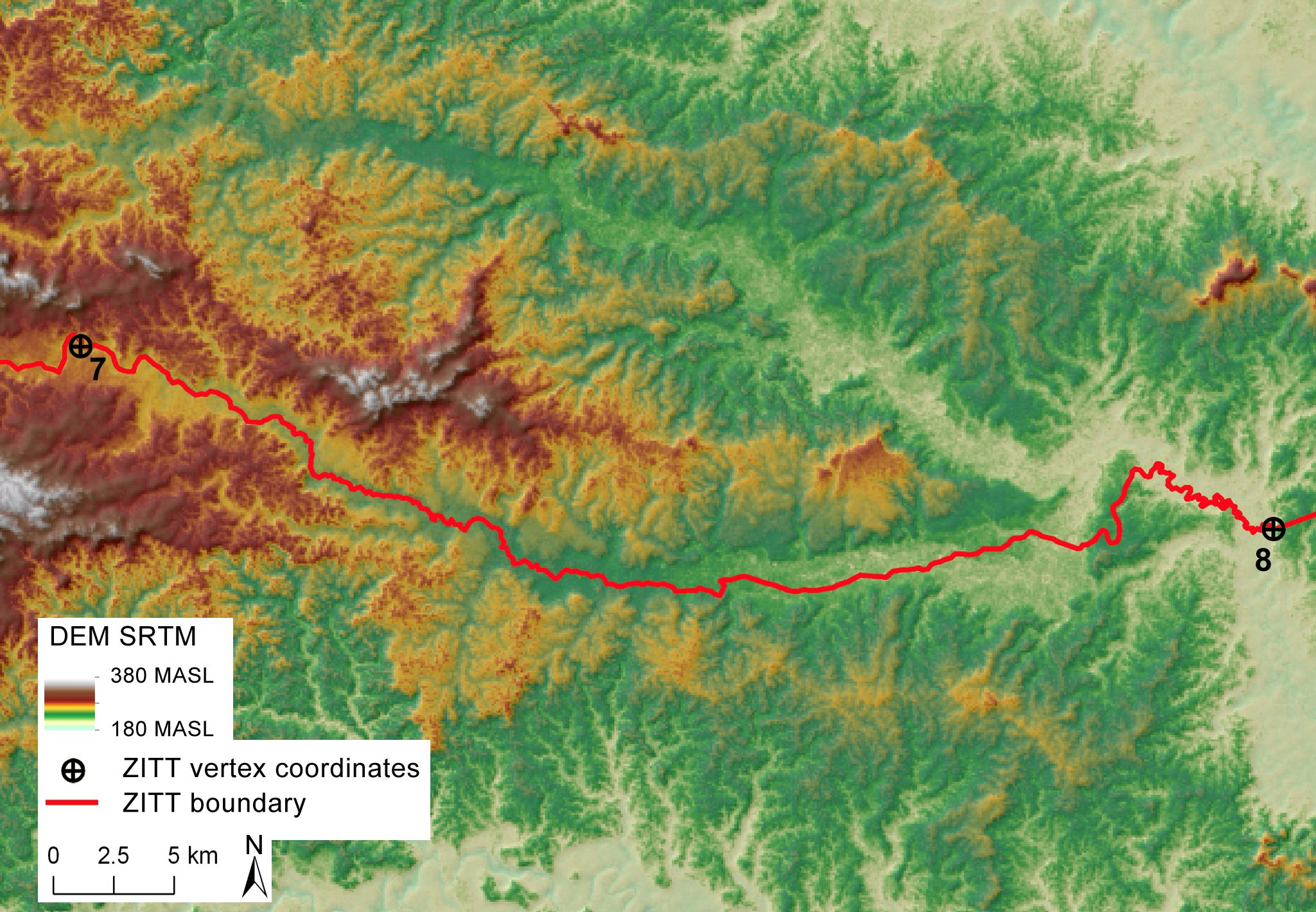
Fig. 4 – Digital Elevation Model (SRTM) analysis between points No. 7 and 8: a critical mapping out of the Zona Intangible Tagaeri Taromenane (ZITT). Figure 4. Digital Elevation Model (SRTM) analysis between points No. 7 and 8: a critical mapping out of the Zona Intangible Tagaeri Taromenane (ZITT). show more The DEM analysis of river dynamic clearly shows that the boundary section, rather than overlapping the Rio Nashiño river bed, drifts away from the river course running over a hills line upper slope. This mapping out violates both the terrain morphology and the same official text (Decree 2187, 2007)

Aggiungi ai preferiti : permalink.

Lascia un Commento