


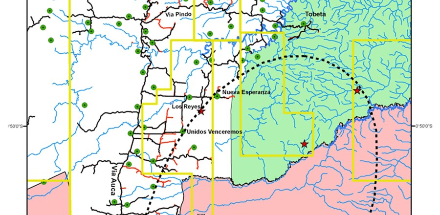
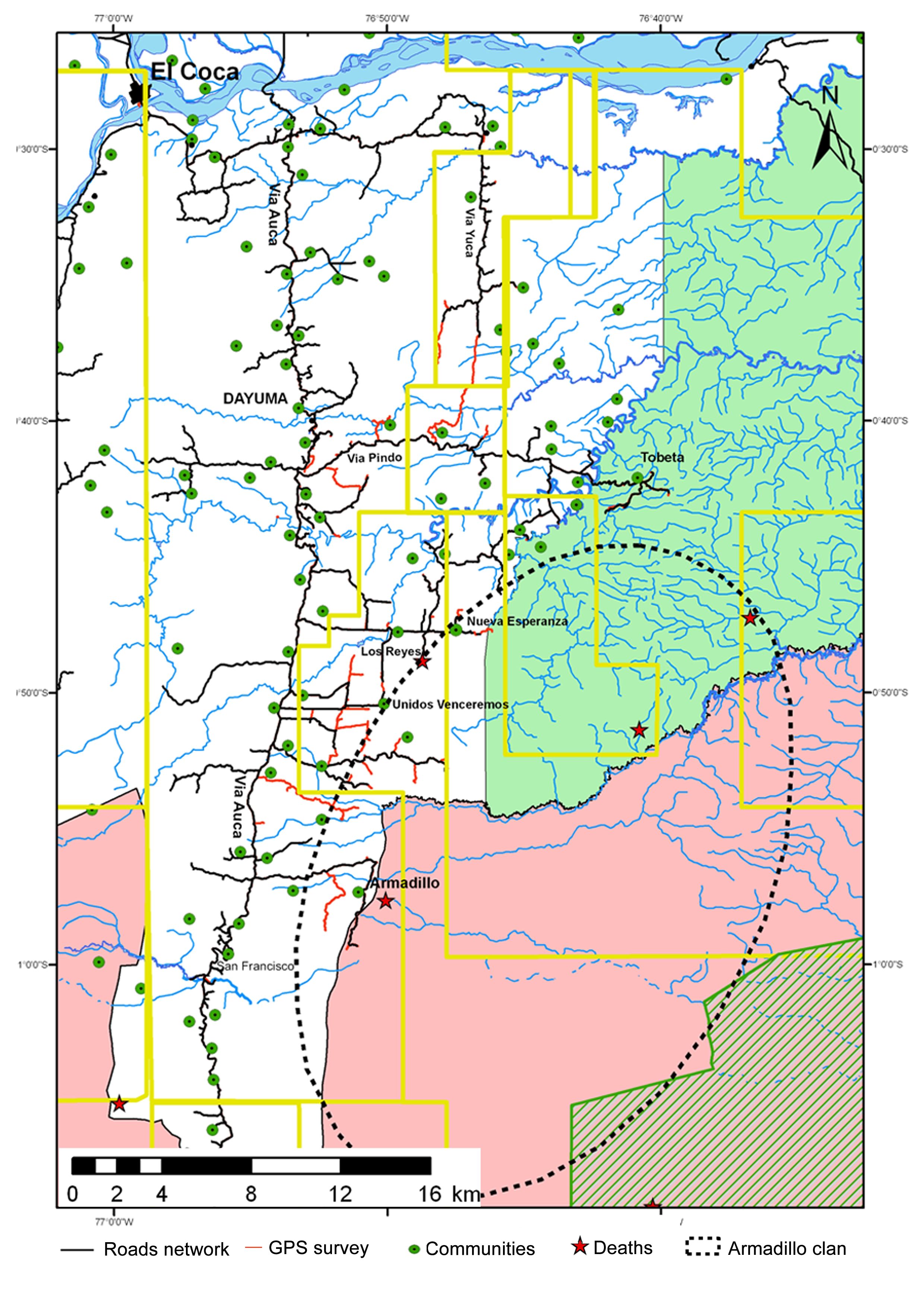
Expansion of the Via Auca road network towards the Yasuní National Park and the Waorani Ethnic Reserve. Oil blocks (yellow lines), historic incidents (red stars) between uncontacted Tagaeri Taromenane groups and external actors, and protected areas. Road network in 2009 by black lines (MAE, 2009) and spatial evolution to the east in 2011 developed by GPS survey (red lines). The map also show the uncontacted Armadillo home range overlapping several oil blocks and the mestizo farmer settlements.